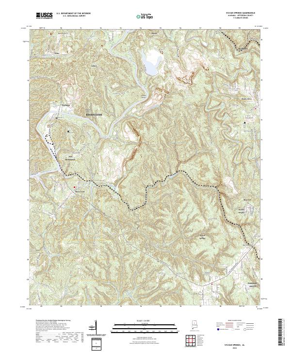
2024 Map of Sylvan Springs
USGS Topo · Published 2024About this map
Locust Fork defines the northern and western reaches of this Jefferson County landscape, where the river's winding path historically supported essential crossings like Williams Ferry and Atwood Ferry. This area of central Alabama reflects a dense network of smaller settlements and industrial transit points, including Praco, Labuco, and Powhatan. Further east, the terrain transitions into more established residential pockets such as Sylvan Springs and Maytown, with the significant landform of Bluff Creek Ridge and the passage at Ben Vines Gap shaping the local geography.
Find a feature on this map
72 named features on this map. Tap any name to fly to it.
Don’t see what you’re looking for? This feature index may not catch every label — zoom into the map to look around manually.
Map Details
Editions of this 2024 Sylvan Springs Map
This is the sole edition of this map. No revisions or reprints were ever made.
Other maps of this area

1889 · Birmingham
USGS Topo · 1:125,000

1890 · Bessemer
USGS Topo · 1:125,000

1892 · Birmingham
USGS Topo · 1:125,000

1892 · Bessemer
USGS Topo · 1:125,000

1893 · Jasper
USGS Topo · 1:125,000

1895 · Birmingham
USGS Topo · 1:125,000

1899 · Brookwood
USGS Topo · 1:125,000

1904 · Birmingham Coal District
USGS Topo · 1:62,500

1905 · Bessemer Iron District
USGS Topo · 1:62,500

1906 · Birmingham Special
USGS Topo · 1:62,500