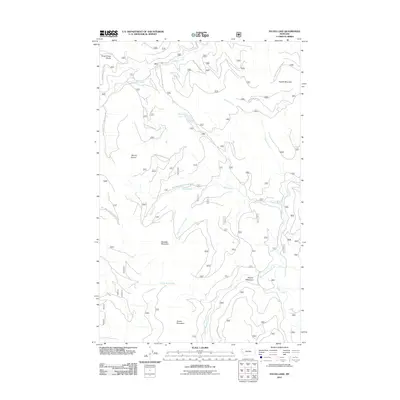
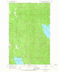
2011 Map of Sylvia Lake
USGS Topo · Published 2011About this map
Sylvia Lake and the surrounding drainages of Flathead County are defined by a complex network of forest development roads that facilitate movement across this high-elevation terrain. This 2011 survey illustrates the hydrological importance of the region, where waters move from the Brush Creek Divide through numerous named tributaries like Sheppard Creek and Little Wolf Creek. The landscape is punctuated by prominent peaks including Mount Conner, Sanders Mountain, and Ingalls Mountain, providing clear reference points for navigation and land management. The presence of Squaw Meadows along Squaw Meadows Creek suggests a natural opening in the dense forest canopy, while the extensive system of National Forest Development Roads, such as Nat Forest Develop Road 5388 RD, shows the infrastructure required for managing these backcountry areas in the modern era.
Find a feature on this map
25 named features on this map. Tap any name to fly to it.
Don’t see what you’re looking for? This feature index may not catch every label — zoom into the map to look around manually.
Map Details
Editions of this 2011 Sylvia Lake Map
This is the sole edition of this map. No revisions or reprints were ever made.
Other maps of this area

1957 · Kalispell
USGS Topo · 1:250,000

1960 · Kalispell
USGS Topo · 1:250,000

1961 · Kalispell
USGS Topo · 1:250,000

1962 · Johnson Peak
USGS Topo · 1:24,000

1962 · Ashley Mountain
USGS Topo · 1:24,000

1963 · Sylvia Lake
USGS Topo · 1:24,000
1963 · Bowen Lake
USGS Topo · 1:24,000
1963 · Dunsire Point
USGS Topo · 1:24,000
1963 · Horse Hill
USGS Topo · 1:24,000
1964 · Pleasant Valley Mountain
USGS Topo · 1:24,000