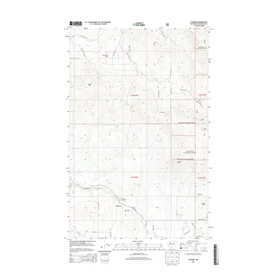
2014 Map of Synarep
USGS Topo · Published 2014About this map
Synarep occupies a pocket of Okanogan County where the Chewiliken Valley and Tunk Valley define the high-plateau geography of north-central Washington. In 2014, the area remains characterized by a network of ranching and forest roads, such as Ed Figlenski Rd and McLaughlin Canyon Rd, that service isolated homesteads like the Fritz Ranch. A significant portion of the eastern landscape falls within the Okanogan National Forest, where prominent peaks like Beehive Mtn and Powers Butte overlook the drainages of Tunk Cr and Chewiliken Cr. For those tracing local genealogy or land use, the Tunk Valley Cem provides a specific point of reference within the scattered settlement pattern. The map also reveals the presence of several high-elevation water sources, including Lounsbury Lake, Davis Lake, and the naturally occurring Tamarack Spring.
Find a feature on this map
44 named features on this map. Tap any name to fly to it.
Don’t see what you’re looking for? This feature index may not catch every label — zoom into the map to look around manually.
Map Details
Editions of this 2014 Synarep Map
This is the sole edition of this map. No revisions or reprints were ever made.
Other maps of this area

1902 · Osoyoos
USGS Topo · 1:125,000

1904 · Osoyoos
USGS Topo · 1:125,000

1952 · Disautel
USGS Topo · 1:62,500

1953 · Omak Lake
USGS Topo · 1:62,500

1954 · Okanogan
USGS Topo · 1:250,000

1957 · Tonasket
USGS Topo · 1:62,500

1957 · Aeneas Valley
USGS Topo · 1:62,500

1958 · Okanogan
USGS Topo · 1:250,000
1980 · Keystone
USGS Topo · 1:24,000
1980 · The Pothole
USGS Topo · 1:24,000