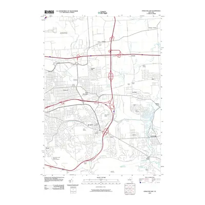
2010 Map of Syracuse East
USGS Topo · Published 2010About this map
De Witt and its surrounding suburbs east of the Syracuse urban core are defined by a complex intersection of heavy transit infrastructure and residential expansion. This landscape is anchored by the sprawling DeWitt Yards and the intersection of major interstates, which sit alongside established communities like East Syracuse, Fayetteville, and Minoa. The map documents a significant concentration of commemorative and civic spaces, including White Chapel Memory Gardens and the De Witt Cemetery-Old Section.
Find a feature on this map
78 named features on this map. Tap any name to fly to it.
Don’t see what you’re looking for? This feature index may not catch every label — zoom into the map to look around manually.
Map Details
Editions of this 2010 Syracuse East Map
This is the sole edition of this map. No revisions or reprints were ever made.
Other maps of this area

1895 · Chittenango
USGS Topo · 1:62,500

1895 · Syracuse
USGS Topo · 1:62,500

1897 · Cazenovia
USGS Topo · 1:62,500

1898 · Syracuse
USGS Topo · 1:62,500

1898 · Chittenango
USGS Topo · 1:62,500

1899 · Cazenovia
USGS Topo · 1:62,500

1900 · Tully
USGS Topo · 1:62,500

1902 · Chittenango
USGS Topo · 1:62,500

1938 · Syracuse East
USGS Topo · 1:24,000

1939 · Syracuse West
USGS Topo · 1:24,000