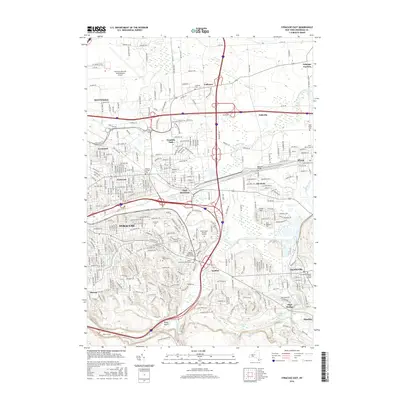
2016 Map of Syracuse East
USGS Topo · Published 2016About this map
Syracuse and its eastern suburbs are defined by a complex intersection of mid-century infrastructure and historic community landmarks. The landscape is carved by the CSX Transportation rail corridor and the meeting of major highways, including the New York State Thruway and the Interstate 481 loop. Within this modern grid, the map preserves the locations of several important local burial grounds, such as the Fayetteville Pioneer Burial Ground and the Messina Springs Cem. Educational and industrial hubs are prominent, with the Le Moyne Coll campus overlooking the residential streets of the city and Syracuse Hancock International Airport anchoring the northern boundary. The terrain transitions from the developed flats of East Syracuse toward the rising ground of Clark Hill and Rams Gulch to the south. Small watercourses like Butternut Creek and Limestone Creek wind through these communities, connecting established settlements like Minoa, Fayetteville, and Manlius.
Find a feature on this map
49 named features on this map. Tap any name to fly to it.
Don’t see what you’re looking for? This feature index may not catch every label — zoom into the map to look around manually.
Map Details
Editions of this 2016 Syracuse East Map
This is the sole edition of this map. No revisions or reprints were ever made.
Other maps of this area

1895 · Chittenango
USGS Topo · 1:62,500

1895 · Syracuse
USGS Topo · 1:62,500

1897 · Cazenovia
USGS Topo · 1:62,500

1898 · Syracuse
USGS Topo · 1:62,500

1898 · Chittenango
USGS Topo · 1:62,500

1899 · Cazenovia
USGS Topo · 1:62,500

1900 · Tully
USGS Topo · 1:62,500

1902 · Chittenango
USGS Topo · 1:62,500

1938 · Syracuse East
USGS Topo · 1:24,000

1939 · Syracuse West
USGS Topo · 1:24,000