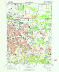
1977 Map of Syracuse East
USGS Topo · Published 1978About this map
The sprawling industrial and suburban landscape east of Syracuse is defined by a massive transportation network in the late 1970s. The New York State Thruway and Conrail lines converge at the immense De Witt Yards, illustrating the region's importance as a logistical hub. To the north, Hancock International Airport and the Hancock Air Force Base occupy significant acreage, while the eastern edge is anchored by the historic path of the Erie Canal and its namesake Erie Canal State Park.
Find a feature on this map
70 named features on this map. Tap any name to fly to it.
Don’t see what you’re looking for? This feature index may not catch every label — zoom into the map to look around manually.
Map Details
Editions of this 1977 Syracuse East Map
This is the sole edition of this map. No revisions or reprints were ever made.
Other maps of this area

1895 · Chittenango
USGS Topo · 1:62,500

1895 · Syracuse
USGS Topo · 1:62,500

1897 · Cazenovia
USGS Topo · 1:62,500

1898 · Syracuse
USGS Topo · 1:62,500

1898 · Chittenango
USGS Topo · 1:62,500

1899 · Cazenovia
USGS Topo · 1:62,500

1900 · Tully
USGS Topo · 1:62,500

1902 · Chittenango
USGS Topo · 1:62,500

1938 · Syracuse East
USGS Topo · 1:24,000

1939 · Syracuse West
USGS Topo · 1:24,000