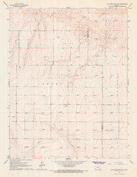
1966 Map of Syracuse East SE
USGS Topo · Published 1967About this map
Lamont and Kendall townships anchor this 1960s survey of western Kansas, where the High Plains landscape is defined by the expansion of energy infrastructure. The map reveals an intensive network of natural gas extraction, with numerous sites such as Gas Well 3252, Gas Well 3354, and Gas Well 3345 dotting the terrain. A major Pipeline cuts across the southern portion of the quadrangle, illustrating the industrial character of the region during this era.
Find a feature on this map
37 named features on this map. Tap any name to fly to it.
Don’t see what you’re looking for? This feature index may not catch every label — zoom into the map to look around manually.
Map Details
Editions of this 1966 Syracuse East SE Map
This is the sole edition of this map. No revisions or reprints were ever made.
Other maps of this area

1891 · Larned
USGS Topo · 1:125,000

1900 · Syracuse
USGS Topo · 1:125,000

1900 · Lakin
USGS Topo · 1:125,000

1920 · Syracuse
USGS Topo · 1:125,000

1955 · Dodge City
USGS Topo · 1:250,000

1958 · Dodge City
USGS Topo · 1:250,000

1959 · Dodge City
USGS Topo · 1:250,000

1959 · Ulysses NW
USGS Topo · 1:24,000

1959 · Big Bow NE
USGS Topo · 1:24,000

1959 · Big Bow NW
USGS Topo · 1:24,000