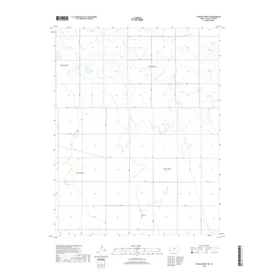
2018 Map of Syracuse West SW
USGS Topo · Published 2018About this map
N Bear Cr carves a winding path through this corner of western Kansas, where the landscape is organized by a precise grid of rural roads. This high-plains terrain in Hamilton County is defined by its agricultural layout, with the intersection of Rd 31 and Rd 36 anchoring the local transportation network. The most significant historical marker on the map is Bear Creek Cem, a vital site for local genealogy and a quiet record of the families who settled this region. Small, scattered wetlands and ephemeral water bodies are visible throughout the northern sections, reflecting the natural drainage patterns that exist alongside the human-made boundaries of townships T25S and T26S. This survey provides a clear view of the area's modern rural character, preserving the exact locations of family burials and local infrastructure as they stood in 2018.
Find a feature on this map
15 named features on this map. Tap any name to fly to it.
Don’t see what you’re looking for? This feature index may not catch every label — zoom into the map to look around manually.
Map Details
Editions of this 2018 Syracuse West SW Map
This is the sole edition of this map. No revisions or reprints were ever made.
Other maps of this area

1891 · Albany
USGS Topo · 1:125,000

1893 · Albany
USGS Topo · 1:125,000

1900 · Syracuse
USGS Topo · 1:125,000

1920 · Syracuse
USGS Topo · 1:125,000

1955 · La Junta
USGS Topo · 1:250,000

1955 · Dodge City
USGS Topo · 1:250,000

1958 · La Junta
USGS Topo · 1:250,000

1958 · Dodge City
USGS Topo · 1:250,000

1959 · Dodge City
USGS Topo · 1:250,000

1966 · Syracuse West SW
USGS Topo · 1:24,000