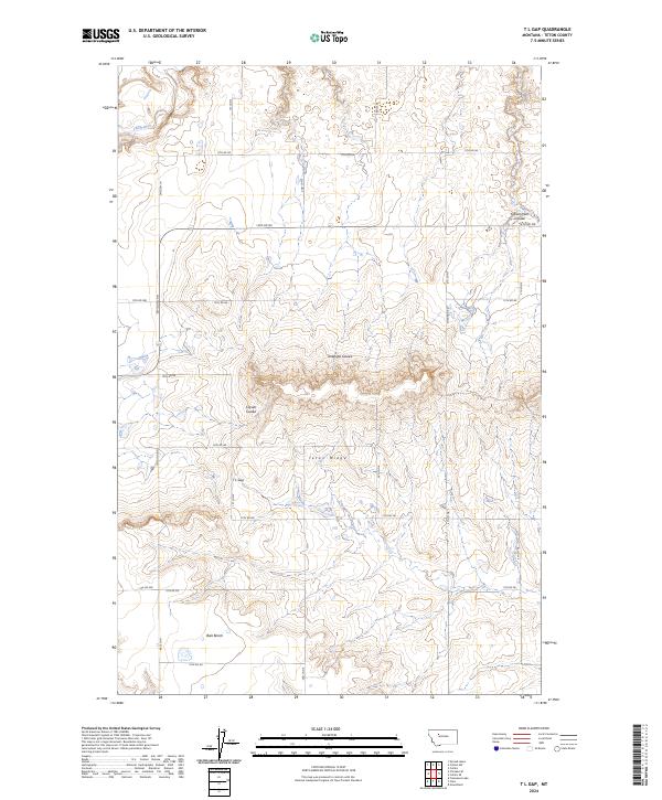
2024 Map of T L Gap
USGS Topo · Published 2024About this map
Teton Ridge dominates the center of this Teton County survey, forming a prominent east-west divide that separates the watershed of the Teton River to the north from the high, flat expanse of Bole Bench to the south. This landscape is defined by its dramatic erosion patterns, with deep draws such as Government Coulee and Antelope Coulee cutting through the terrain. The central passage at T L Gap serves as a natural transition point through the ridge, likely influencing local travel and grazing patterns. The map reflects a structured rural landscape organized by a rigorous grid of section lines and gravel roads, including 17th Rd NE and 10th Rd NE, which serve the agricultural and ranching operations of this Montana high-plains environment. The absence of dense settlement highlights the character of the region as a land of wide-open coulees and expansive benches.
Find a feature on this map
23 named features on this map. Tap any name to fly to it.
Don’t see what you’re looking for? This feature index may not catch every label — zoom into the map to look around manually.
Map Details
Editions of this 2024 T L Gap Map
This is the sole edition of this map. No revisions or reprints were ever made.
Other maps of this area

1886 · Great Falls
USGS Topo · 1:250,000

1920 · Choteau
USGS Topo · 1:125,000

1950 · Fairfield
USGS Topo · 1:62,500

1950 · Collins
USGS Topo · 1:62,500

1954 · Great Falls
USGS Topo · 1:250,000

1955 · Choteau
USGS Topo · 1:250,000

1957 · Choteau
USGS Topo · 1:250,000

1957 · Great Falls
USGS Topo · 1:250,000

1958 · Choteau
USGS Topo · 1:250,000

1960 · Choteau
USGS Topo · 1:62,500