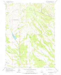
1962 Map of Tabby Mountain
USGS Topo · Published 1978About this map
Ashley National Forest encompasses the high country of the western Uintah Basin, where the peaks of Tabby Mountain and Grey Wolf Mountain dominate the horizon. In the early 1960s, this landscape was defined by its water sources and deep-cut drainages like Right Fork Cockey Hollow and Santaquin Draw. The Red Creek Reservoir serves as a central landmark, collecting flows from Red Creek and Tabby Creek to support the surrounding basin.
Find a feature on this map
34 named features on this map. Tap any name to fly to it.
Don’t see what you’re looking for? This feature index may not catch every label — zoom into the map to look around manually.
Map Details
Editions of this 1962 Tabby Mountain Map
2 editions found
Other maps of this area

1885 · Uinta
USGS Topo · 1:250,000

1954 · Salt Lake City
USGS Topo · 1:250,000

1958 · Salt Lake City
USGS Topo · 1:250,000

1960 · Salt Lake City
USGS Topo · 1:250,000

1962 · Deep Creek Canyon
USGS Topo · 1:24,000

1962 · Strawberry Pinnacles
USGS Topo · 1:24,000
1962 · Wolf Creek
USGS Topo · 1:24,000

1962 · Fruitland
USGS Topo · 1:24,000

1962 · Hanna
USGS Topo · 1:24,000

1962 · Tabiona
USGS Topo · 1:24,000