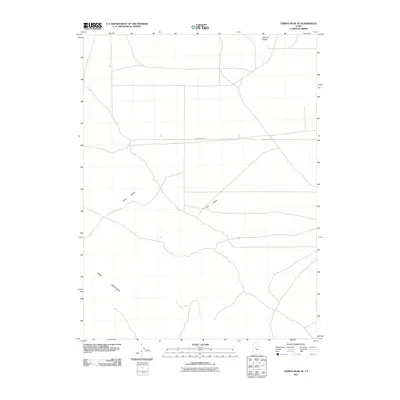
2011 Map of Tabbys Peak SE
USGS Topo · Published 2011About this map
The northern slopes of the Cedar Mountains transition into a structured grid of rural corridors and drainage patterns in this corner of Tooele County. The landscape is defined by its arid topography, where seasonal watercourses like Wide Hollow and Post Hollow carve through the terrain before meeting the flatter expanses to the north. These hollows provide a natural relief against the prominent Hickman Knolls that rise near the northern boundary. Settlement is sparse, with human activity primarily represented by the linear path of White Rocks Rd, which serves as a central east-west artery through this high-desert environment. The map captures a moment in the early 21st century when the area remained largely undeveloped, characterized by the intersection of topographic features and the utilitarian road network of the Great Basin.
Find a feature on this map
5 named features on this map. Tap any name to fly to it.
Don’t see what you’re looking for? This feature index may not catch every label — zoom into the map to look around manually.
Map Details
Editions of this 2011 Tabbys Peak SE Map
This is the sole edition of this map. No revisions or reprints were ever made.
Other maps of this area

1885 · Tooele Valley
USGS Topo · 1:250,000

1953 · Tooele
USGS Topo · 1:250,000

1954 · Camels Back Ridge NW
USGS Topo · 1:24,000

1955 · Tabbys Peak SE
USGS Topo · 1:24,000

1955 · Tabbys Peak
USGS Topo · 1:24,000

1955 · Camels Back Ridge NE
USGS Topo · 1:24,000

1955 · Davis Knolls
USGS Topo · 1:24,000

1955 · Deseret Peak
USGS Topo · 1:62,500

1955 · Tabbys Peak SW
USGS Topo · 1:24,000

1955 · Tooele
USGS Topo · 1:250,000