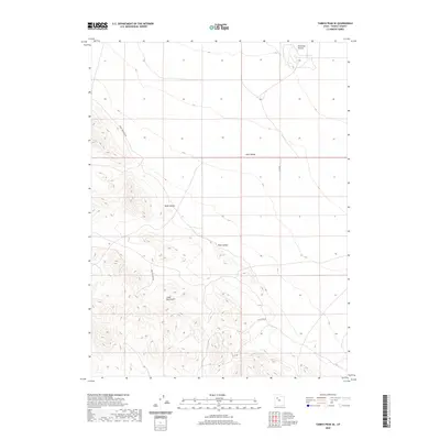
2020 Map of Tabbys Peak SE
USGS Topo · Published 2020About this map
The Cedar Mountains define the western landscape of this Tooele County region, their slopes dropping sharply into the broad expanse of Skull Valley. This area is characterized by dramatic topographic transitions, where high-elevation ridges meet the arid basin floor. Local travel is marked by remote routes such as Cedar Mountain Rd and Post Hollow Rd, which navigate the rugged drainages of Wide Hollow and Post Hollow. At the northern edge of the map, the Hickman Knolls stand as a distinct landform within the valley, highlighting the unique geological character of the Great Basin. This recent survey by the U.S. Geological Survey captures the contemporary state of these public lands, detailing the sparse road network like Wildfire Ln that provides access to this isolated interior terrain.
Find a feature on this map
8 named features on this map. Tap any name to fly to it.
Don’t see what you’re looking for? This feature index may not catch every label — zoom into the map to look around manually.
Map Details
Editions of this 2020 Tabbys Peak SE Map
This is the sole edition of this map. No revisions or reprints were ever made.
Other maps of this area

1885 · Tooele Valley
USGS Topo · 1:250,000

1953 · Tooele
USGS Topo · 1:250,000

1954 · Camels Back Ridge NW
USGS Topo · 1:24,000

1955 · Tabbys Peak SE
USGS Topo · 1:24,000

1955 · Tabbys Peak
USGS Topo · 1:24,000

1955 · Camels Back Ridge NE
USGS Topo · 1:24,000

1955 · Davis Knolls
USGS Topo · 1:24,000

1955 · Deseret Peak
USGS Topo · 1:62,500

1955 · Tabbys Peak SW
USGS Topo · 1:24,000

1955 · Tooele
USGS Topo · 1:250,000