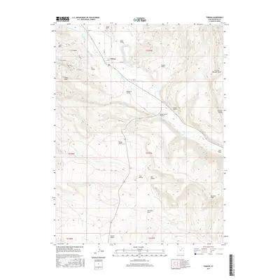
2017 Map of Tabiona
USGS Topo · Published 2017About this map
Tabiona sits along the north bank of the Duchesne River, serving as a central hub for the surrounding livestock and agricultural operations. The landscape is defined by an intricate network of irrigation systems, including the Jepp-Thomas Canal, Bridger Ditch, and Jasper Pike Canal, which draw from the river to support the arid Uinta Valley. This 2017 survey reveals how water rights and land management are etched into the terrain, with local names like Hicken Ditch and Farm Cr Canal marking the distribution of resources across the valley floor. To the north, the Tabiona-Redcliff Cem overlooks the town, while the surrounding geography transitions into a series of deeply carved drainages such as Golden Stairs Canyon and Rabbit Gulch. These features, alongside Blacktail Ridge and Windy Ridge, highlight the complex topography that has historically constrained and directed local development.
Find a feature on this map
42 named features on this map. Tap any name to fly to it.
Don’t see what you’re looking for? This feature index may not catch every label — zoom into the map to look around manually.
Map Details
Editions of this 2017 Tabiona Map
This is the sole edition of this map. No revisions or reprints were ever made.
Other maps of this area

1885 · Uinta
USGS Topo · 1:250,000

1954 · Salt Lake City
USGS Topo · 1:250,000

1958 · Salt Lake City
USGS Topo · 1:250,000

1960 · Salt Lake City
USGS Topo · 1:250,000

1962 · Strawberry Pinnacles
USGS Topo · 1:24,000

1962 · Blacktail Mtn
USGS Topo · 1:24,000

1962 · Fruitland
USGS Topo · 1:24,000

1962 · Hanna
USGS Topo · 1:24,000

1962 · Tabiona
USGS Topo · 1:24,000

1962 · Rabbit Gulch
USGS Topo · 1:24,000