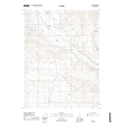
2020 Map of Tabiona
USGS Topo · Published 2020About this map
Tabiona sits along the upper reaches of the Duchesne River, serving as a central hub for the surrounding canyons and high ridges of Duchesne County. This landscape is defined by an intricate network of irrigation systems, including the Jepp Thomas Canal, Jasper Pike Canal, and Farm Cr Canal, which draw water from the river to support the narrow agricultural valleys. The terrain transitions from the broad Uinta Valley in the southeast to the higher elevations of Windy Ridge and Blacktail Ridge. Genealogists and local historians can locate the Tabiona Redcliff Cem north of the main settlement, while geographical landmarks like Golden Stairs Canyon and Rabbit Gulch illustrate the complex drainage patterns of the region. The map also documents a web of rural roads such as Carter Ln and Giles Ranch Ln, which connect the scattered homesteads and ranching operations throughout Hidden Valley and Little Valley.
Find a feature on this map
38 named features on this map. Tap any name to fly to it.
Don’t see what you’re looking for? This feature index may not catch every label — zoom into the map to look around manually.
Map Details
Editions of this 2020 Tabiona Map
This is the sole edition of this map. No revisions or reprints were ever made.
Other maps of this area

1885 · Uinta
USGS Topo · 1:250,000

1954 · Salt Lake City
USGS Topo · 1:250,000

1958 · Salt Lake City
USGS Topo · 1:250,000

1960 · Salt Lake City
USGS Topo · 1:250,000

1962 · Strawberry Pinnacles
USGS Topo · 1:24,000

1962 · Blacktail Mtn
USGS Topo · 1:24,000

1962 · Fruitland
USGS Topo · 1:24,000

1962 · Hanna
USGS Topo · 1:24,000

1962 · Tabiona
USGS Topo · 1:24,000

1962 · Rabbit Gulch
USGS Topo · 1:24,000