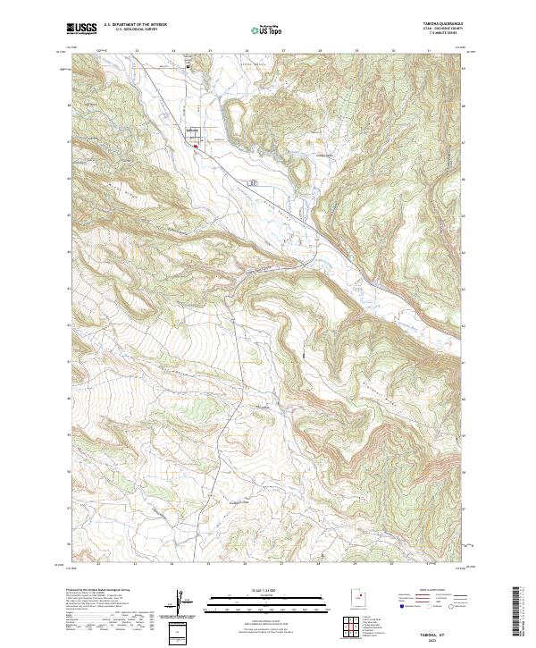
2023 Map of Tabiona
USGS Topo · Published 2023About this map
The Duchesne River carves through the heart of the Uinta Valley in this modern survey of Duchesne County. The settlement of Tabiona serves as the focal point for the surrounding agricultural and ranching landscape, supported by a complex network of irrigation infrastructure including the Jasper Pike Canal, Farm Creek Canal, and Tabby Canal. This intricate system of ditches and canals reflects the community's historical reliance on managed water in a high-desert environment. To the north of the town site, the Tabiona Redcliff Cem stands as a significant landmark for genealogical research.
Find a feature on this map
40 named features on this map. Tap any name to fly to it.
Don’t see what you’re looking for? This feature index may not catch every label — zoom into the map to look around manually.
Map Details
Editions of this 2023 Tabiona Map
This is the sole edition of this map. No revisions or reprints were ever made.
Other maps of this area

1885 · Uinta
USGS Topo · 1:250,000

1954 · Salt Lake City
USGS Topo · 1:250,000

1958 · Salt Lake City
USGS Topo · 1:250,000

1960 · Salt Lake City
USGS Topo · 1:250,000

1962 · Strawberry Pinnacles
USGS Topo · 1:24,000

1962 · Blacktail Mtn
USGS Topo · 1:24,000

1962 · Fruitland
USGS Topo · 1:24,000

1962 · Hanna
USGS Topo · 1:24,000

1962 · Tabiona
USGS Topo · 1:24,000

1962 · Rabbit Gulch
USGS Topo · 1:24,000