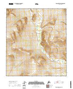
2018 Map of Table Mountain A-5 SW
USGS Topo · Published 2018About this map
Monument Creek defines the interior drainage of this high-latitude terrain within the Yukon-Koyukuk Census Area. The landscape is characterized by a high-density network of contours and unnamed summits, with the watercourse of Monument Cr winding through the central and eastern sections of the township grid. The map's focus on the Public Land Survey System reveals the systematic partitioning of this subarctic wilderness into sections within t15s r35e, t15s r36e, and surrounding ranges. This 2018 survey provides a clear view of the topographical relief and water drainage patterns in a region where human-made infrastructure is absent, emphasizing the raw physical geography of the Alaska interior.
Find a feature on this map
8 named features on this map. Tap any name to fly to it.
Don’t see what you’re looking for? This feature index may not catch every label — zoom into the map to look around manually.
Map Details
Editions of this 2018 Table Mountain A-5 SW Map
This is the sole edition of this map. No revisions or reprints were ever made.
Other maps of this area

1951 · Coleen
USGS Topo · 1:250,000

1951 · Christian
USGS Topo · 1:250,000

1951 · Arctic
USGS Topo · 1:250,000

1951 · Table Mountain
USGS Topo · 1:250,000

1956 · Table Mountain
USGS Topo · 1:250,000

1956 · Coleen
USGS Topo · 1:250,000

1956 · Arctic
USGS Topo · 1:250,000

1956 · Christian
USGS Topo · 1:250,000

1964 · Table Mountain
USGS Topo · 1:250,000
1972 · Arctic A-1
USGS Topo · 1:63,360