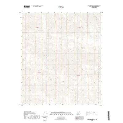
2018 Map of Table Mountain D-2 NE
USGS Topo · Published 2018About this map
Steep, high-elevation terrain dominates this portion of the Alaska North Slope, where the landscape is defined by its extreme isolation and dramatic relief. Surveyed in 2018, the quadrangle provides a precise look at the township and range divisions within the eastern Brooks Range, specifically covering sections of T5s R43e, T5s R44e, T6s R43e, and T6s R44e. There are no named settlements, roads, or localized landmarks printed on this sheet, leaving the dense contour lines and drainage patterns as the primary information for those studying the physical geography of this northern wilderness. The map is a testament to the scale of the North Slope Borough, where vertical elevation changes are the most prominent features of the land.
Find a feature on this map
4 named features on this map. Tap any name to fly to it.
Don’t see what you’re looking for? This feature index may not catch every label — zoom into the map to look around manually.
Map Details
Editions of this 2018 Table Mountain D-2 NE Map
This is the sole edition of this map. No revisions or reprints were ever made.
Other maps of this area

1951 · Demarcation Point
USGS Topo · 1:250,000

1951 · Table Mountain
USGS Topo · 1:250,000

1955 · Demarcation Point
USGS Topo · 1:250,000

1956 · Table Mountain
USGS Topo · 1:250,000

1964 · Table Mountain
USGS Topo · 1:250,000

1964 · Demarcation Point
USGS Topo · 1:250,000

1983 · Table Mountain D-2
USGS Topo · 1:63,360

1983 · Demarcation Point A-2
USGS Topo · 1:63,360

1983 · Table Mountain D-1
USGS Topo · 1:63,360
1983 · Demarcation Point A-1
USGS Topo · 1:63,360