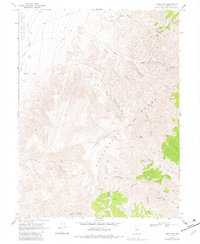
1969 Map of Table Mtn
USGS Topo · Published 1982About this map
The Stillwater Range dominates this Churchill County landscape, rising sharply from the western edge where the Stillwater Wildlife Management Area meets the foot of the mountains. This 1969 field survey details a network of narrow canyons and high peaks, including Mount Lincoln and the Slaughter Peaks, which defined the local topography before modern development. Notable for those interested in the era's land use, the map identifies sparse but critical water sources like Hard Time Spring and West Lee Well, alongside evidence of industrial activity at several Borrow Pits. The presence of a single telephone line and numerous Jeep Trails carving through Quaking Aspen Canyon and Long Pete Canyon illustrates the area's remote character and the reliance on primitive road networks for access to the high desert terrain.
Find a feature on this map
31 named features on this map. Tap any name to fly to it.
Don’t see what you’re looking for? This feature index may not catch every label — zoom into the map to look around manually.
Map Details
Editions of this 1969 Table Mtn Map
3 editions found
Other maps of this area

1908 · Carson Sink
USGS Topo · 1:250,000

1910 · Carson Sink
USGS Topo · 1:250,000

1957 · Reno
USGS Topo · 1:250,000

1959 · Reno
USGS Topo · 1:250,000

1960 · Reno
USGS Topo · 1:250,000

1969 · Cox Canyon
USGS Topo · 1:24,000

1969 · Table Mtn
USGS Topo · 1:24,000

1969 · Pintail Bay
USGS Topo · 1:24,000

1969 · Foxtail Lake
USGS Topo · 1:24,000

1972 · Pirouette Mtn
USGS Topo · 1:24,000