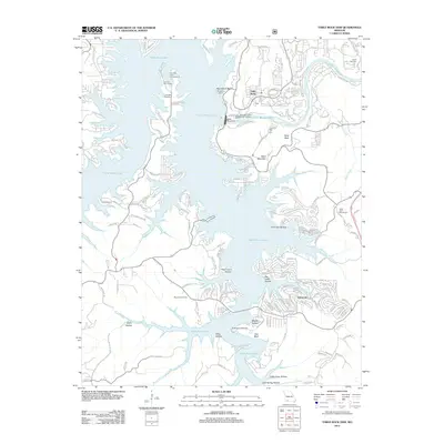
2012 Map of Table Rock Dam
USGS Topo · Published 2012About this map
Table Rock Dam stands as the central engineering feat of this landscape, separating the massive reach of Table Rock Lake from the narrower course of Lake Taneycomo. The topography is defined by the Ozark Plateau's deeply incised drainages, including Clevinger Hollow and Persimmon Hollow, which give way to the prominent elevation of Baird Mountain. This 2012 survey illustrates the modern development of the area as a major recreation and residential hub, with dense street networks appearing at Oakmont and the settlement of Table Rock. Local history and genealogy are preserved in sites like the Goodall Cemetery, Bowman Cemetery, and Logan Cemetery, which remain as markers of the families who settled this region long before the valley was flooded for power and flood control. The map also identifies specific conservation and infrastructure points, such as the Shepherd of the Hills Fish Hatchery and an AT&T Micro Wave Tower.
Find a feature on this map
152 named features on this map. Tap any name to fly to it.
Don’t see what you’re looking for? This feature index may not catch every label — zoom into the map to look around manually.
Map Details
Editions of this 2012 Table Rock Dam Map
This is the sole edition of this map. No revisions or reprints were ever made.
Other maps of this area

1904 · Harrison
USGS Topo · 1:125,000

1905 · Harrison
USGS Topo · 1:125,000

1907 · Forsyth
USGS Topo · 1:125,000

1945 · Harrison
USGS Topo · 1:250,000

1949 · Harrison
USGS Topo · 1:250,000

1950 · Garber
USGS Topo · 1:24,000

1954 · Harrison
USGS Topo · 1:250,000

1956 · Lampe
USGS Topo · 1:24,000

1956 · Table Rock Dam
USGS Topo · 1:24,000

1956 · Garber
USGS Topo · 1:24,000