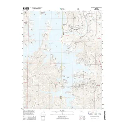
2015 Map of Table Rock Dam
USGS Topo · Published 2015About this map
Table Rock Dam stands as the central engineering marvel of this Ozark landscape, regulating the flow between the expansive Table Rock Lake and the winding Lake Taneycomo. The shoreline is heavily indented with numerous hollows such as Clevinger Hollow and Big Cedar Hollow, reflecting the complex topography that defines the region's tourism and residential patterns. Settlements like Branson and Hollister appear well-established along the northeastern corridors, while smaller communities like Oakmont and Blue Eye mark the more rural southern stretches. For local historians, the map provides precise locations for several burial sites, including Goodall Cemetery, Logan Cemetery, and Bowman Cemetery, which remain preserved amidst the growing development. The inclusion of Mark Twain National Forest land and landmarks like Moonshine Beach highlights the area's dual character as a protected wilderness and a premiere recreational destination.
Find a feature on this map
44 named features on this map. Tap any name to fly to it.
Don’t see what you’re looking for? This feature index may not catch every label — zoom into the map to look around manually.
Map Details
Editions of this 2015 Table Rock Dam Map
This is the sole edition of this map. No revisions or reprints were ever made.
Other maps of this area

1904 · Harrison
USGS Topo · 1:125,000

1905 · Harrison
USGS Topo · 1:125,000

1907 · Forsyth
USGS Topo · 1:125,000

1945 · Harrison
USGS Topo · 1:250,000

1949 · Harrison
USGS Topo · 1:250,000

1950 · Garber
USGS Topo · 1:24,000

1954 · Harrison
USGS Topo · 1:250,000

1956 · Lampe
USGS Topo · 1:24,000

1956 · Table Rock Dam
USGS Topo · 1:24,000

1956 · Garber
USGS Topo · 1:24,000