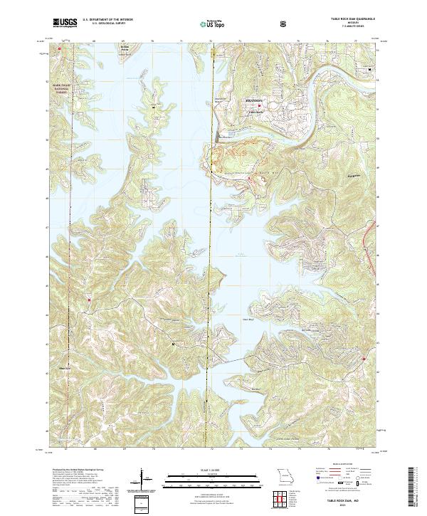
2021 Map of Table Rock Dam
USGS Topo · Published 2021About this map
Table Rock Dam controls the waters of the White River, creating the expansive Table Rock Lake that dominates this Ozark landscape. The terrain is defined by steep ridges and winding hollows, such as Compton Ridge and Persimmon Hollow, which reflect the complex topography of the White River Valley. Settlement patterns here are a mix of traditional rural communities and modern development, with the town of Branson and the neighboring Hollister positioned near the water's edge.
Find a feature on this map
185 named features on this map. Tap any name to fly to it.
Don’t see what you’re looking for? This feature index may not catch every label — zoom into the map to look around manually.
Map Details
Editions of this 2021 Table Rock Dam Map
This is the sole edition of this map. No revisions or reprints were ever made.
Other maps of this area

1904 · Harrison
USGS Topo · 1:125,000

1905 · Harrison
USGS Topo · 1:125,000

1907 · Forsyth
USGS Topo · 1:125,000

1945 · Harrison
USGS Topo · 1:250,000

1949 · Harrison
USGS Topo · 1:250,000

1950 · Garber
USGS Topo · 1:24,000

1954 · Harrison
USGS Topo · 1:250,000

1956 · Lampe
USGS Topo · 1:24,000

1956 · Table Rock Dam
USGS Topo · 1:24,000

1956 · Garber
USGS Topo · 1:24,000