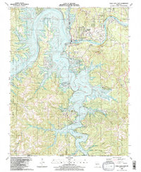
1989 Map of Table Rock Dam
USGS Topo · Published 1989About this map
Table Rock Dam and the Powerhouse dominate this late 20th-century landscape, marking the massive infrastructure that separates the waters of Table Rock Lake from the White River and Lake Taneycomo. The area reflects a complex layering of utility, recreation, and regional history, from the Shepherd of the Hills State Fish Hatchery and Table Rock State Park to the small residential pockets at Table Rock Townsite.
Find a feature on this map
62 named features on this map. Tap any name to fly to it.
Don’t see what you’re looking for? This feature index may not catch every label — zoom into the map to look around manually.
Map Details
Editions of this 1989 Table Rock Dam Map
This is the sole edition of this map. No revisions or reprints were ever made.
Other maps of this area

1904 · Harrison
USGS Topo · 1:125,000

1905 · Harrison
USGS Topo · 1:125,000

1907 · Forsyth
USGS Topo · 1:125,000

1945 · Harrison
USGS Topo · 1:250,000

1949 · Harrison
USGS Topo · 1:250,000

1950 · Garber
USGS Topo · 1:24,000

1954 · Harrison
USGS Topo · 1:250,000

1956 · Lampe
USGS Topo · 1:24,000

1956 · Table Rock Dam
USGS Topo · 1:24,000

1956 · Garber
USGS Topo · 1:24,000