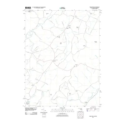
2011 Map of Table Rock
USGS Topo · Published 2011About this map
The Youghiogheny River winds through this highlands region along the Maryland and West Virginia border, defining a landscape of high ridges and agricultural valleys. Small rural settlements like Gortner and Redhouse anchor the local road network, which is dotted with family and community landmarks such as the Triple Silo Farm and Greater Gortner Airport. The area’s genealogical record is well-preserved through numerous burial sites, including Gortner Cemetery, Red House Cemetery, and Beckman Cemetery, which sit among the headwaters of Cherry Creek and Ambrose Run. To the south, the terrain rises toward Moon Ridge and Roth Rock, eventually descending to the North Branch Potomac River at the community of Wilson. This 2011 survey illustrates the persistent rural character of the Appalachian plateau, where prominent features like Conneway Hill and Table Rock overlook a patchwork of farms and mountain streams.
Find a feature on this map
82 named features on this map. Tap any name to fly to it.
Don’t see what you’re looking for? This feature index may not catch every label — zoom into the map to look around manually.
Map Details
Editions of this 2011 Table Rock Map
This is the sole edition of this map. No revisions or reprints were ever made.
Other maps of this area

1886 · St. George
USGS Topo · 1:125,000

1891 · St. George
USGS Topo · 1:125,000

1895 · Piedmont
USGS Topo · 1:125,000

1899 · Oakland
USGS Topo · 1:62,500

1900 · Oakland
USGS Topo · 1:62,500

1907 · Kingwood
USGS Topo · 1:62,500

1908 · Parsons
USGS Topo · 1:62,500

1916 · Davis
USGS Topo · 1:48,000

1918 · Davis
USGS Topo · 1:62,500

1919 · Davis
USGS Topo · 1:62,500