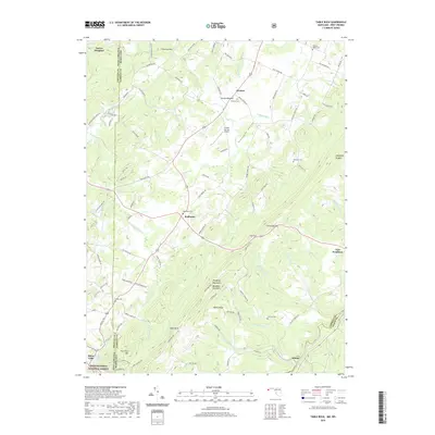
2019 Map of Table Rock
USGS Topo · Published 2019About this map
The Youghiogheny River and the North Branch Potomac River define the hydrography of this borderland region, where the high ridges of the Allegheny Mountains meet the Maryland-West Virginia state line. Centered on the crossroads of Redhouse, the landscape is marked by high-elevation features like Backbone Mountain and the prominent Table Rock. A network of rural cemeteries, including Gortner Cem, Red House Cem, and Beckman Cem, anchors the small farming and residential settlements that dot the valleys. In the southern reach, the Monongahela National Forest covers the terrain near Silver Lake, while the eastern edge is defined by the historical site of Fort Pendleton. The coexistence of the Greater Gortner Airport and the surrounding mountain ridges reflects the modern utility of this upland plateau, known locally as Pleasant Valley.
Find a feature on this map
106 named features on this map. Tap any name to fly to it.
Don’t see what you’re looking for? This feature index may not catch every label — zoom into the map to look around manually.
Map Details
Editions of this 2019 Table Rock Map
This is the sole edition of this map. No revisions or reprints were ever made.
Other maps of this area

1886 · St. George
USGS Topo · 1:125,000

1891 · St. George
USGS Topo · 1:125,000

1895 · Piedmont
USGS Topo · 1:125,000

1899 · Oakland
USGS Topo · 1:62,500

1900 · Oakland
USGS Topo · 1:62,500

1907 · Kingwood
USGS Topo · 1:62,500

1908 · Parsons
USGS Topo · 1:62,500

1916 · Davis
USGS Topo · 1:48,000

1918 · Davis
USGS Topo · 1:62,500

1919 · Davis
USGS Topo · 1:62,500