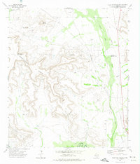
1972 Map of Table Top Mountain
USGS Topo · Published 1974About this map
Southwest Mesa dominates this West Texas landscape, a prominent geological formation defined by deep escarpments and complex drainage patterns. The 1970s era saw significant energy infrastructure here, with the Crockett Oil Field and Tippett Oil Field marking the terrain with a network of oil wells, drill holes, and crisscrossing pipelines. The Pecos River and its tributaries, including Fivemile Creek and Javelina Draw, carve through the arid environment, providing the primary water courses for the region.
Find a feature on this map
19 named features on this map. Tap any name to fly to it.
Don’t see what you’re looking for? This feature index may not catch every label — zoom into the map to look around manually.
Map Details
Editions of this 1972 Table Top Mountain Map
This is the sole edition of this map. No revisions or reprints were ever made.
Other maps of this area

1928 · Crane
USGS Topo · 1:125,000

1928 · Rankin
USGS Topo · 1:125,000

1929 · Sheffield
USGS Topo · 1:125,000

1929 · Independence Draw Quadrangle
USGS Topo · 1:125,000

1954 · Pecos
USGS Topo · 1:250,000

1954 · Fort Stockton
USGS Topo · 1:250,000

1954 · Sonora
USGS Topo · 1:250,000

1954 · San Angelo
USGS Topo · 1:250,000

1957 · Pecos
USGS Topo · 1:250,000

1958 · Sonora
USGS Topo · 1:250,000