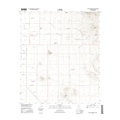
2017 Map of Table Top Mountain
USGS Topo · Published 2017About this map
Table Top Mountain rises as a prominent landmark in this desert landscape of southern New Mexico, south of the Pyramid Mountains. The terrain is defined by a series of north-south running ridges and canyons, including Woodhaul Canyon and Pinkey Wright Canyon, which drain into the broad Rainbow Wash. This 2017 survey illustrates the sparse but essential water management infrastructure of the arid region, marking various catchment points such as Section Fifteen Tank, Johnson Tank, and Joes Tank. The western portion of the map shows a network of rural roads with locally significant names like Palo Verde Rd, Sorgo Rd, and Boothill Rd, providing access to the rugged Threemile Hills and the foothills of Lightning Dock Mtn.
Find a feature on this map
41 named features on this map. Tap any name to fly to it.
Don’t see what you’re looking for? This feature index may not catch every label — zoom into the map to look around manually.
Map Details
Editions of this 2017 Table Top Mountain Map
This is the sole edition of this map. No revisions or reprints were ever made.
Other maps of this area

1918 · Playas
USGS Topo · 1:62,500

1918 · Pratt
USGS Topo · 1:62,500

1919 · Pratt
USGS Topo · 1:62,500

1919 · Playas
USGS Topo · 1:62,500

1954 · Silver City
USGS Topo · 1:250,000

1955 · Douglas
USGS Topo · 1:250,000

1958 · Silver City
USGS Topo · 1:250,000

1959 · Douglas
USGS Topo · 1:250,000

1961 · Douglas
USGS Topo · 1:250,000

1962 · Silver City
USGS Topo · 1:250,000