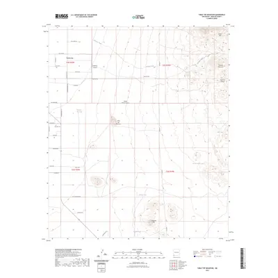
2023 Map of Table Top Mountain
USGS Topo · Published 2023About this map
Cotton City anchors the northwest corner of this arid landscape, where the flat basin meets the rising slopes of the Pyramid Mountains and Table Top Mountain. The area is defined by a network of drainage systems including Rainbow Wash, Holtkamp Canyon, and Pinkey Wright Canyon, which cut through the elevated terrain of the Russel Hills and Threemile Hills. For genealogists and local historians, the Busy Bee Cem serves as a small but significant landmark along Sorgo Rd. The map also illustrates the importance of water management in this environment, featuring numerous scattered catchments such as Johnson Tank, Joes Tank, and Foothill Tank. A grid of county roads and named lanes, such as Bosque Seco Rd and Quarterhorse Ln, provides access to the various sections of this high-desert ranching and mountain country.
Find a feature on this map
41 named features on this map. Tap any name to fly to it.
Don’t see what you’re looking for? This feature index may not catch every label — zoom into the map to look around manually.
Map Details
Editions of this 2023 Table Top Mountain Map
This is the sole edition of this map. No revisions or reprints were ever made.
Other maps of this area

1918 · Playas
USGS Topo · 1:62,500

1918 · Pratt
USGS Topo · 1:62,500

1919 · Pratt
USGS Topo · 1:62,500

1919 · Playas
USGS Topo · 1:62,500

1954 · Silver City
USGS Topo · 1:250,000

1955 · Douglas
USGS Topo · 1:250,000

1958 · Silver City
USGS Topo · 1:250,000

1959 · Douglas
USGS Topo · 1:250,000

1961 · Douglas
USGS Topo · 1:250,000

1962 · Silver City
USGS Topo · 1:250,000