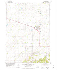
1978 Map of Tabor
USGS Topo · Published 1979About this map
The town of Tabor serves as the focal point of this late-1970s landscape, situated along the diagonal corridor of the Chicago Milwaukee St Paul and Pacific railroad. This map reveals a community defined by its water resources and cultural landmarks, featuring several named water bodies such as Kubal Lake, Hruska Lake, and Pechous Lake that dot the surrounding plains. For genealogists and local historians, the inclusion of Hvezda Zapadu Cem and Ptaks National Cem provides specific points for family research within this rural setting. The topography is also shaped by industrial activity, with several Gravel Pits and Sandpits scattered across the township, particularly near the Bon Homme and Yankton county line. Small-scale water features like Beaver Creek and Charley Creek wind through the agricultural sections, completing the picture of this eastern South Dakota prairie community.
Find a feature on this map
18 named features on this map. Tap any name to fly to it.
Don’t see what you’re looking for? This feature index may not catch every label — zoom into the map to look around manually.
Map Details
Editions of this 1978 Tabor Map
This is the sole edition of this map. No revisions or reprints were ever made.
Other maps of this area

1898 · Olivet
USGS Topo · 1:125,000

1955 · Sioux City
USGS Topo · 1:250,000

1955 · Sioux Falls
USGS Topo · 1:250,000

1958 · Sioux City
USGS Topo · 1:250,000

1958 · Sioux Falls
USGS Topo · 1:250,000

1959 · Sioux City
USGS Topo · 1:250,000

1968 · Tabor SE
USGS Topo · 1:24,000

1974 · Bon Homme Colony
USGS Topo · 1:24,000

1978 · Tripp SE
USGS Topo · 1:24,000
1978 · Santee
USGS Topo · 1:24,000
Featured Places
- Tabor, SD
- Ziskov North Township, SD
- Lesterville Township, SD
- Lincoln Township, SD
- Little Tabor Township, SD