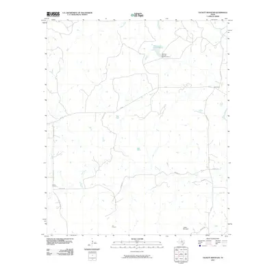
2010 Map of Tackett Mountain
USGS Topo · Published 2010About this map
Tackett Mountain dominates the southern landscape of this Young County region, where the terrain is defined by the winding course of the Brazos River and its numerous tributaries. Settled ranching and rural life are evident through the network of local roads such as Panhandle Rd and Murray Cemetery Rd, which connect remote homesteads to the small settlement of Drummond. The hydrography of the area is particularly noteworthy, featuring artificial water sources like Tub Tank and Bait Tank, alongside the managed waters of Manning Vick Lake Number 2 and its associated Manning Vick Lake Number 2 Dam.
Find a feature on this map
26 named features on this map. Tap any name to fly to it.
Don’t see what you’re looking for? This feature index may not catch every label — zoom into the map to look around manually.
Map Details
Editions of this 2010 Tackett Mountain Map
This is the sole edition of this map. No revisions or reprints were ever made.
Other maps of this area

1890 · Breckenridge
USGS Topo · 1:125,000

1925 · Graham 4-c
USGS Topo · 1:48,000

1925 · Breckenridge 1-b
USGS Topo · 1:48,000

1927 · Graham
USGS Topo · 1:62,500

1931 · Ivan
USGS Topo · 1:62,500

1954 · Abilene
USGS Topo · 1:250,000

1954 · Wichita Falls
USGS Topo · 1:250,000

1958 · Wichita Falls
USGS Topo · 1:250,000

1958 · Abilene
USGS Topo · 1:250,000

1964 · Newcastle
USGS Topo · 1:24,000