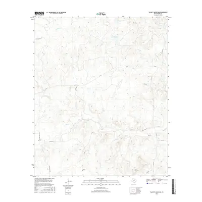
2016 Map of Tackett Mountain
USGS Topo · Published 2016About this map
Murray occupies the western edge of this Young County landscape, a region defined by the complex drainage systems that feed toward the Brazos River in the east. Numerous small water features, including Tub Tank and Bait Tank, indicate a pastoral environment where water management is central to the land's utility. The topography rises significantly toward Tackett Mountain in the southeast, while the northern reaches are marked by the presence of Woodward Lake and Manning Vick Lake Number 2. For genealogists, the map preserves the locations of Murray Cem and Tyra Cem, essential landmarks for tracing family history in this part of Texas. A network of rural routes, such as Macabee Rd and FM 3109, connects the dispersed ranching properties like Fisher Ranch Rd to the wider county infrastructure.
Find a feature on this map
29 named features on this map. Tap any name to fly to it.
Don’t see what you’re looking for? This feature index may not catch every label — zoom into the map to look around manually.
Map Details
Editions of this 2016 Tackett Mountain Map
This is the sole edition of this map. No revisions or reprints were ever made.
Other maps of this area

1890 · Breckenridge
USGS Topo · 1:125,000

1925 · Graham 4-c
USGS Topo · 1:48,000

1925 · Breckenridge 1-b
USGS Topo · 1:48,000

1927 · Graham
USGS Topo · 1:62,500

1931 · Ivan
USGS Topo · 1:62,500

1954 · Abilene
USGS Topo · 1:250,000

1954 · Wichita Falls
USGS Topo · 1:250,000

1958 · Wichita Falls
USGS Topo · 1:250,000

1958 · Abilene
USGS Topo · 1:250,000

1964 · Newcastle
USGS Topo · 1:24,000