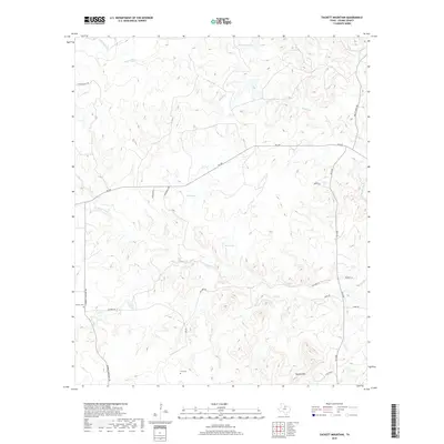
2019 Map of Tackett Mountain
USGS Topo · Published 2019About this map
Murray occupies the western edge of this Young County landscape, a rural settlement defined by its proximity to the Murray Cem. The terrain is deeply etched by a network of seasonal waterways and creeks, including Fish Cr, Ratiff Br, and Cribb Station Cr, which drain toward the Brazos River visible in the northeast. Significant elevation is found at Tackett Mtn, providing a vantage point over the ranching lands and small stock ponds such as Tub Tank and Bait Tank. This 2019 survey documents a region where local heritage is preserved in family and community burial grounds like Tyra Cem. The map illustrates how modern county roads and farm-to-market routes, including FM 209 and FM 3109, follow the contours of the land, connecting scattered homesteads and ranches while respecting the natural flow of the creek beds.
Find a feature on this map
28 named features on this map. Tap any name to fly to it.
Don’t see what you’re looking for? This feature index may not catch every label — zoom into the map to look around manually.
Map Details
Editions of this 2019 Tackett Mountain Map
This is the sole edition of this map. No revisions or reprints were ever made.
Other maps of this area

1890 · Breckenridge
USGS Topo · 1:125,000

1925 · Graham 4-c
USGS Topo · 1:48,000

1925 · Breckenridge 1-b
USGS Topo · 1:48,000

1927 · Graham
USGS Topo · 1:62,500

1931 · Ivan
USGS Topo · 1:62,500

1954 · Abilene
USGS Topo · 1:250,000

1954 · Wichita Falls
USGS Topo · 1:250,000

1958 · Wichita Falls
USGS Topo · 1:250,000

1958 · Abilene
USGS Topo · 1:250,000

1964 · Newcastle
USGS Topo · 1:24,000