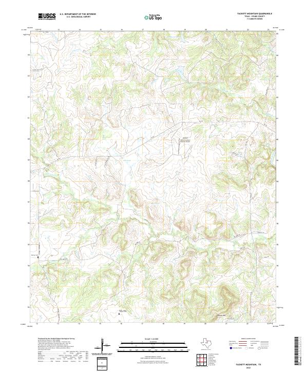
2022 Map of Tackett Mountain
USGS Topo · Published 2022About this map
Tackett Mtn stands as a prominent landmark in this portion of Young County, overlooking a landscape defined by the winding course of the Brazos River and its numerous tributaries. The map documents a rural Texas environment where ranching infrastructure and local history intersect, evidenced by small water features like Tub Tank and Bait Tank. This 2022 survey captures the modern road network, including FM 209 and FM 3109, which connect isolated homesteads and family-named landmarks.
Find a feature on this map
28 named features on this map. Tap any name to fly to it.
Don’t see what you’re looking for? This feature index may not catch every label — zoom into the map to look around manually.
Map Details
Editions of this 2022 Tackett Mountain Map
This is the sole edition of this map. No revisions or reprints were ever made.
Other maps of this area

1890 · Breckenridge
USGS Topo · 1:125,000

1925 · Graham 4-c
USGS Topo · 1:48,000

1925 · Breckenridge 1-b
USGS Topo · 1:48,000

1927 · Graham
USGS Topo · 1:62,500

1931 · Ivan
USGS Topo · 1:62,500

1954 · Abilene
USGS Topo · 1:250,000

1954 · Wichita Falls
USGS Topo · 1:250,000

1958 · Wichita Falls
USGS Topo · 1:250,000

1958 · Abilene
USGS Topo · 1:250,000

1964 · Newcastle
USGS Topo · 1:24,000