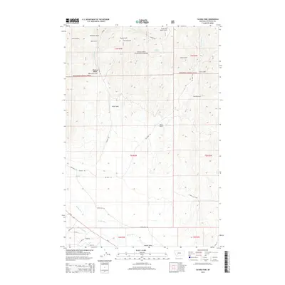
2014 Map of Tacoma Park
USGS Topo · Published 2014About this map
Boulder Valley serves as the focal point for agricultural and ranching activity in this southern Jefferson County landscape. Along the winding course of the Boulder River, a network of ranch access roads and the Carey-Twohy Ditch illustrate the complex irrigation and water management required for high-altitude Montana ranching. To the north, the terrain transitions into the heavily timbered slopes of the Deerlodge National Forest, where a series of steep drainages such as Hunting Gulch and Clarke Gulch dominate the topography. Localized landmarks like Blazing Place and Watertank Gulch point to the area's specialized land use, while reliable water sources including Tacoma Spring and Deadman Spring remain critical features in the high country. The map also traces the path of Elkhorn Rd, linking the valley floor to the more remote parklands of Tacoma Park.
Find a feature on this map
43 named features on this map. Tap any name to fly to it.
Don’t see what you’re looking for? This feature index may not catch every label — zoom into the map to look around manually.
Map Details
Editions of this 2014 Tacoma Park Map
This is the sole edition of this map. No revisions or reprints were ever made.
Other maps of this area

1886 · Fort Logan
USGS Topo · 1:250,000

1889 · Helena
USGS Topo · 1:250,000

1893 · Helena
USGS Topo · 1:250,000

1899 · Boulder
USGS Topo · 1:125,000

1899 · Helena
USGS Topo · 1:250,000

1903 · Helena
USGS Topo · 1:250,000

1947 · Butte
USGS Topo · 1:250,000

1948 · White Sulphur Springs
USGS Topo · 1:250,000

1950 · Devils Fence
USGS Topo · 1:62,500

1950 · Jefferson City
USGS Topo · 1:62,500