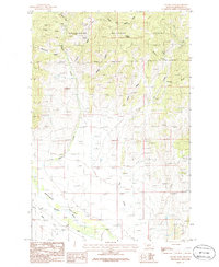
1986 Map of Tacoma Park
USGS Topo · Published 1986About this map
Deerlodge National Forest dominates the northern reaches of this map, where a legacy of hard-rock exploration is etched into the landscape through numerous Mine Shafts and scattered Prospects. The drainages of Tacoma Creek and Elkhorn Creek flow south toward the Boulder Valley, illustrating a classic Western mountain-to-basin transition. This 1980s landscape remains largely industrial and utilitarian, marked by a Sub Station, the Trans Line, and extensive Tailings near the central creeks.
Find a feature on this map
31 named features on this map. Tap any name to fly to it.
Don’t see what you’re looking for? This feature index may not catch every label — zoom into the map to look around manually.
Map Details
Editions of this 1986 Tacoma Park Map
This is the sole edition of this map. No revisions or reprints were ever made.
Other maps of this area

1886 · Fort Logan
USGS Topo · 1:250,000

1889 · Helena
USGS Topo · 1:250,000

1893 · Helena
USGS Topo · 1:250,000

1899 · Boulder
USGS Topo · 1:125,000

1899 · Helena
USGS Topo · 1:250,000

1903 · Helena
USGS Topo · 1:250,000

1947 · Butte
USGS Topo · 1:250,000

1948 · White Sulphur Springs
USGS Topo · 1:250,000

1950 · Devils Fence
USGS Topo · 1:62,500

1950 · Jefferson City
USGS Topo · 1:62,500