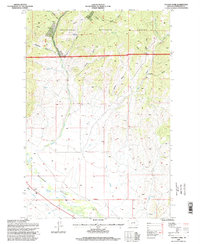
1996 Map of Tacoma Park
USGS Topo · Published 1998About this map
Deerlodge National Forest dominates this landscape in Jefferson County, where the high mountain terrain meets the wide alluvial expanse of the Boulder Valley. The map documents a significant intersection of drainage systems and resource extraction, with numerous unnamed prospects and a named mine situated in the north near Tacoma Gulch. The presence of tailings and scattered prospect pits across the eastern slopes of the forest suggests a legacy of mineral exploration that persists alongside natural features like Tacoma Spring and Deadman Spring.
Find a feature on this map
32 named features on this map. Tap any name to fly to it.
Don’t see what you’re looking for? This feature index may not catch every label — zoom into the map to look around manually.
Map Details
Editions of this 1996 Tacoma Park Map
This is the sole edition of this map. No revisions or reprints were ever made.
Other maps of this area

1886 · Fort Logan
USGS Topo · 1:250,000

1889 · Helena
USGS Topo · 1:250,000

1893 · Helena
USGS Topo · 1:250,000

1899 · Boulder
USGS Topo · 1:125,000

1899 · Helena
USGS Topo · 1:250,000

1903 · Helena
USGS Topo · 1:250,000

1947 · Butte
USGS Topo · 1:250,000

1948 · White Sulphur Springs
USGS Topo · 1:250,000

1950 · Devils Fence
USGS Topo · 1:62,500

1950 · Jefferson City
USGS Topo · 1:62,500