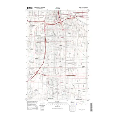
2014 Map of Tacoma South
USGS Topo · Published 2014About this map
The Puyallup River and its accompanying industrial corridors dominate the landscape of South Tacoma and its neighboring suburbs in this 2014 survey. Highlighting the intersection of art and infrastructure, the Chihuly Bridge of Glass and Puyallup Avenue Bridge connect the downtown core to the Port of Tacoma Interchange. The map provides a detailed view of the suburban expansion south toward Spanaway and Frederickson, including the established neighborhoods of Fern Hill, Salishan, and Oakland.
Find a feature on this map
74 named features on this map. Tap any name to fly to it.
Don’t see what you’re looking for? This feature index may not catch every label — zoom into the map to look around manually.
Map Details
Editions of this 2014 Tacoma South Map
This is the sole edition of this map. No revisions or reprints were ever made.
Other maps of this area

1897 · Tacoma
USGS Topo · 1:125,000

1900 · Tacoma
USGS Topo · 1:125,000

1940 · Anderson Island
USGS Topo · 1:62,500

1941 · Tacoma South
USGS Topo · 1:62,500

1942 · Gig Harbor
USGS Topo · 1:62,500

1943 · Gig Harbor
USGS Topo · 1:62,500

1944 · Tacoma South
USGS Topo · 1:62,500

1948 · Anderson Island
USGS Topo · 1:62,500

1948 · Fort Lewis
USGS Topo · 1:24,000

1948 · Steilacoom
USGS Topo · 1:24,000