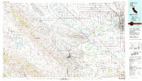
1981 Map of Taft
USGS Topo · Published 1982About this map
The Naval Petroleum Reserve No 1 and Naval Petroleum Reserve No 2 dominate the center of this landscape, illustrating the critical role of energy extraction in the development of western Kern County. The map captures a complex industrial and natural geography where the arid Carrizo Plain meets the oil-rich Buena Vista Hills. The intricate infrastructure of the California Aqueduct and various sloughs like Jerry Slough underscore the massive water-management efforts required for both agriculture and settlement in the southern San Joaquin Valley.
Find a feature on this map
74 named features on this map. Tap any name to fly to it.
Don’t see what you’re looking for? This feature index may not catch every label — zoom into the map to look around manually.
Map Details
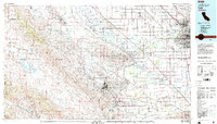
Editions of this 1981 Taft Map
2 editions found
Other maps of this area

1902 · Santa Ynez
USGS Topo · 1:125,000

1903 · Mt. Pinos
USGS Topo · 1:125,000

1903 · Tejon
USGS Topo · 1:125,000

1905 · Santa Ynez
USGS Topo · 1:125,000

1905 · Lompoc
USGS Topo · 1:125,000

1906 · Bakersfield
USGS Topo · 1:62,500

1910 · Buena Vista Lake
USGS Topo · 1:125,000

1912 · McKittrick
USGS Topo · 1:125,000

1912 · Buena Vista Lake
USGS Topo · 1:125,000

1914 · Caliente
USGS Topo · 1:125,000