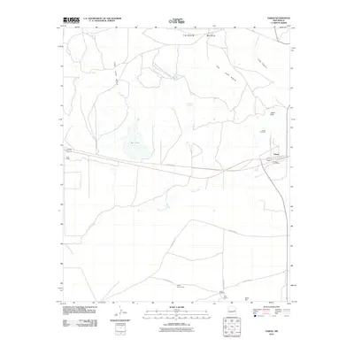
2010 Map of Taiban
USGS Topo · Published 2010About this map
Taiban serves as the primary focal point of this eastern New Mexico landscape, situated where the high plains meet the dramatic rise of The Cap Rock and Taiban Mesa. This 2010 topographic record highlights the importance of water and ranching infrastructure in De Baca County, with numerous named water sources like Dripping Spring, Taiban Spring, and Frank Windmill scattered across the arid terrain. The map captures the small-scale civic footprint of the area through the Taiban Post Office and the nearby Taiban Cemetery, providing essential coordinates for local genealogists and history researchers.
Find a feature on this map
21 named features on this map. Tap any name to fly to it.
Don’t see what you’re looking for? This feature index may not catch every label — zoom into the map to look around manually.
Map Details
Editions of this 2010 Taiban Map
This is the sole edition of this map. No revisions or reprints were ever made.
Other maps of this area

1954 · Fort Sumner
USGS Topo · 1:250,000

1954 · Clovis
USGS Topo · 1:250,000

1958 · Fort Sumner
USGS Topo · 1:250,000

1958 · Clovis
USGS Topo · 1:250,000

1968 · Lomas Gatos
USGS Topo · 1:24,000

1968 · Fort Sumner East
USGS Topo · 1:24,000

1968 · Candy Mesa
USGS Topo · 1:24,000

1968 · Taiban
USGS Topo · 1:24,000

1968 · Bonner Lake
USGS Topo · 1:24,000

1968 · Twin Mesa
USGS Topo · 1:24,000