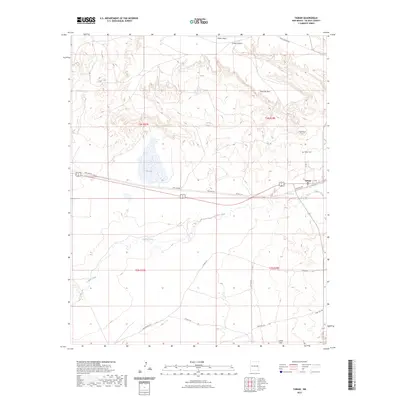
2023 Map of Taiban
USGS Topo · Published 2023About this map
Taiban serves as the central point of interest in this De Baca County landscape, situated along a transportation corridor defined by Munger Ave and Co Rd 3-10. The area is characterized by dramatic elevation changes, with the northern reaches dominated by the high plateau of Taiban Mesa and the prominent escarpment known as The Cap Rock. Local history is anchored by the Taiban Cem, while the arid geography is marked by essential water sources like Taiban Spring and Dripping Spring. The drainage patterns of Taiban Creek wind through the southern sections, eventually giving way to the rising elevation of Sand Hill. This 2023 survey illustrates the sparse, rural nature of the region where cattle ranching and land management are tied to the available hydrology of Red Lake and the shelter provided by Long Canyon and Taiban Peak.
Find a feature on this map
25 named features on this map. Tap any name to fly to it.
Don’t see what you’re looking for? This feature index may not catch every label — zoom into the map to look around manually.
Map Details
Editions of this 2023 Taiban Map
This is the sole edition of this map. No revisions or reprints were ever made.
Other maps of this area

1954 · Fort Sumner
USGS Topo · 1:250,000

1954 · Clovis
USGS Topo · 1:250,000

1958 · Fort Sumner
USGS Topo · 1:250,000

1958 · Clovis
USGS Topo · 1:250,000

1968 · Lomas Gatos
USGS Topo · 1:24,000

1968 · Fort Sumner East
USGS Topo · 1:24,000

1968 · Candy Mesa
USGS Topo · 1:24,000

1968 · Taiban
USGS Topo · 1:24,000

1968 · Bonner Lake
USGS Topo · 1:24,000

1968 · Twin Mesa
USGS Topo · 1:24,000