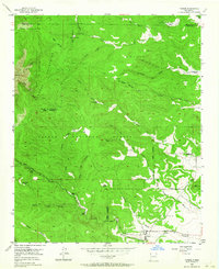
1954 Map of Tajique
USGS Topo · Published 1964About this map
Tajique lies at the base of the Manzano Mountains in Torrance County, serving as a hub for a network of deep-cut canyons and historical homesteads. This mid-century survey reveals a landscape defined by the transition from the Cibola National Forest to the open valley floor, where the Arroyo de Tajique and Tajique Loop Road connect the main settlement to outlying landmarks. Family-named sites like the King Place, Riley Place, and Glover Place are scattered among the ridges, while the northern section is dominated by the Isleta Indian Reservation (Lo De Padilla). Historical agricultural and social footprints are visible through the noted Barales Sch (Abdn) and ranching operations such as El Chinchonte Ranch and La Jara Ranch. The intricate naming of local features, from Cañon del Apache to Cañon de la Miga, reflects a deeply localized geography of water and wood used by generations of inhabitants.
Find a feature on this map
80 named features on this map. Tap any name to fly to it.
Don’t see what you’re looking for? This feature index may not catch every label — zoom into the map to look around manually.
Map Details
Editions of this 1954 Tajique Map
2 editions found
Other maps of this area

1917 · Estancia
USGS Topo · 1:125,000

1954 · Bosque Peak
USGS Topo · 1:24,000

1954 · Chilili
USGS Topo · 1:24,000

1954 · Capilla Peak
USGS Topo · 1:24,000

1954 · Mount Washington
USGS Topo · 1:24,000

1954 · Torreon
USGS Topo · 1:24,000

1954 · Tajique
USGS Topo · 1:24,000

1954 · Escabosa
USGS Topo · 1:24,000

1954 · Milbourn Ranch
USGS Topo · 1:24,000

1954 · Torreon
USGS Topo · 1:62,500