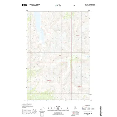
2017 Map of Taku River A-6 NW
USGS Topo · Published 2017About this map
The Tongass National Forest defines the environment of this 2017 survey, where a complex network of freshwater systems flows through steep elevation changes. Central to the landscape is Lake Dorothy, which feeds into Dorothy Cr as it winds through the northwest. Further east, the Long River follows a deep drainage pattern, connecting southward towards Long Lake. These water features, alongside Crater Cr and Lieuy Lake, illustrate the glacially carved topography characteristic of the Juneau City and Borough region. The map reveals the intricate natural boundaries and land management zones within the national forest, emphasizing the primary role of hydrologic features in a landscape where human settlement is absent.
Find a feature on this map
11 named features on this map. Tap any name to fly to it.
Don’t see what you’re looking for? This feature index may not catch every label — zoom into the map to look around manually.
Map Details
Editions of this 2017 Taku River A-6 NW Map
This is the sole edition of this map. No revisions or reprints were ever made.
Other maps of this area

1948 · Juneau B-1
USGS Topo · 1:63,360

1951 · Juneau
USGS Topo · 1:250,000

1951 · Taku River B-6
USGS Topo · 1:63,360

1951 · Taku River A-6
USGS Topo · 1:63,360

1951 · Juneau A-1
USGS Topo · 1:63,360

1952 · Juneau B-1
USGS Topo · 1:63,360

1953 · Taku River
USGS Topo · 1:250,000

1954 · Juneau A-1
USGS Topo · 1:63,360

1960 · Taku River
USGS Topo · 1:250,000

1962 · Juneau
USGS Topo · 1:250,000