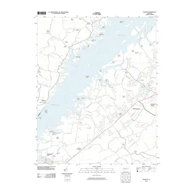
2010 Map of Talbott
USGS Topo · Published 2010About this map
Cherokee Lake dominates this landscape, its expansive waters formed by the Cherokee Dam on the Holston River. The reservoir's irregular shoreline creates numerous inlets and points such as Horseshoe Bend and Point Lookout, while recreational hubs like Wa-Ni Boat Dock and May Springs Campground reflect the area's development around the water. On the eastern side, the expansion of Morristown and Jefferson City is evident, with the Morristown Municipal Airport serving as a key regional landmark.
Find a feature on this map
120 named features on this map. Tap any name to fly to it.
Don’t see what you’re looking for? This feature index may not catch every label — zoom into the map to look around manually.
Map Details
Editions of this 2010 Talbott Map
This is the sole edition of this map. No revisions or reprints were ever made.
Other maps of this area

1883 · Morristown
USGS Topo · 1:125,000

1893 · Morristown
USGS Topo · 1:125,000

1895 · Morristown
USGS Topo · 1:125,000

1897 · Maynardville
USGS Topo · 1:125,000

1900 · Maynardville
USGS Topo · 1:125,000

1935 · White Pine
USGS Topo · 1:24,000

1935 · Tate Springs
USGS Topo · 1:48,000

1935 · Straw Plains
USGS Topo · 1:48,000

1935 · Joppa
USGS Topo · 1:24,000

1935 · Avondale
USGS Topo · 1:24,000