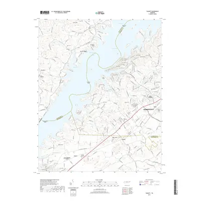
2019 Map of Talbott
USGS Topo · Published 2019About this map
Cherokee Lake dominates the northern landscape of this region, its indented shoreline creating numerous peninsulas and deep coves like Happy Hollow and Allen Hollow. This modern topographic study shows the developed interface between the water and established communities such as Wa-Ni Village and Alpha Heights. The southern portion of the map is defined by the intersection of Morristown and Jefferson City, where residential growth surrounds the Moore-Murrell Airport and transportation corridors.
Find a feature on this map
211 named features on this map. Tap any name to fly to it.
Don’t see what you’re looking for? This feature index may not catch every label — zoom into the map to look around manually.
Map Details
Editions of this 2019 Talbott Map
This is the sole edition of this map. No revisions or reprints were ever made.
Other maps of this area

1883 · Morristown
USGS Topo · 1:125,000

1893 · Morristown
USGS Topo · 1:125,000

1895 · Morristown
USGS Topo · 1:125,000

1897 · Maynardville
USGS Topo · 1:125,000

1900 · Maynardville
USGS Topo · 1:125,000

1935 · White Pine
USGS Topo · 1:24,000

1935 · Tate Springs
USGS Topo · 1:48,000

1935 · Straw Plains
USGS Topo · 1:48,000

1935 · Joppa
USGS Topo · 1:24,000

1935 · Avondale
USGS Topo · 1:24,000