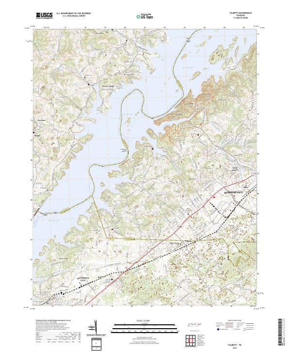
2022 Map of Talbott
USGS Topo · Published 2022About this map
Cherokee Lake dominates the center of this landscape, its fingers reaching into the coves of Hamblen and Jefferson counties. The shoreline is marked by early settlements and recreational sites like Wa-Ni Village and the Horseshoe Bend Rapids. To the east, the urban expansion of Morristown and Alpha presses toward the rural hills, while Jefferson City anchors the southwestern corner. The terrain reveals a history of resource extraction at Ore Mine Hill and Mine Ridge, connected by a network of modern trails including the Point Lookout Trl and Ridge Crest Trl. Genealogists will find a high density of family burial grounds preserved here, such as the Martha Sunderland Cem, Blackwell Cem, and Sitton Cem, which remain as quiet landmarks of the area's agricultural and pioneer heritage amidst 21st-century development.
Find a feature on this map
75 named features on this map. Tap any name to fly to it.
Don’t see what you’re looking for? This feature index may not catch every label — zoom into the map to look around manually.
Map Details
Editions of this 2022 Talbott Map
This is the sole edition of this map. No revisions or reprints were ever made.
Other maps of this area

1883 · Morristown
USGS Topo · 1:125,000

1893 · Morristown
USGS Topo · 1:125,000

1895 · Morristown
USGS Topo · 1:125,000

1897 · Maynardville
USGS Topo · 1:125,000

1900 · Maynardville
USGS Topo · 1:125,000

1935 · White Pine
USGS Topo · 1:24,000

1935 · Tate Springs
USGS Topo · 1:48,000

1935 · Straw Plains
USGS Topo · 1:48,000

1935 · Joppa
USGS Topo · 1:24,000

1935 · Avondale
USGS Topo · 1:24,000