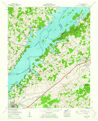
1960 Map of Talbott
USGS Topo · Published 1963About this map
The complex shoreline of Cherokee Lake dominates this landscape, created by the Cherokee Dam at the western edge of the sheet. Located where Hamblen, Grainger, and Jefferson counties meet, the map captures a period of transition as traditional farming and railroad life near the Southern line adapted to new lakefront recreation and industrial expansion. Established communities like Talbott and Alpha sit inland along the Andrew Johnson Highway, while the waterfront features newer developments like Wa-Ni Village and the Panther Creek Recreation Area. The presence of the Morristown Municipal Airport (Murrell Field) and a local drive-in theater signals the mid-century modernization of this rural Tennessee corridor. Local history is anchored by several country churches, including New Blackwell Branch Ch and Mt Pleasant Church, alongside long-standing family landmarks like Bacon Cem.
Find a feature on this map
59 named features on this map. Tap any name to fly to it.
Don’t see what you’re looking for? This feature index may not catch every label — zoom into the map to look around manually.
Map Details
Editions of this 1960 Talbott Map
This is the sole edition of this map. No revisions or reprints were ever made.
Other maps of this area

1883 · Morristown
USGS Topo · 1:125,000

1893 · Morristown
USGS Topo · 1:125,000

1895 · Morristown
USGS Topo · 1:125,000

1897 · Maynardville
USGS Topo · 1:125,000

1900 · Maynardville
USGS Topo · 1:125,000

1935 · White Pine
USGS Topo · 1:24,000

1935 · Tate Springs
USGS Topo · 1:48,000

1935 · Straw Plains
USGS Topo · 1:48,000

1935 · Joppa
USGS Topo · 1:24,000

1935 · Avondale
USGS Topo · 1:24,000