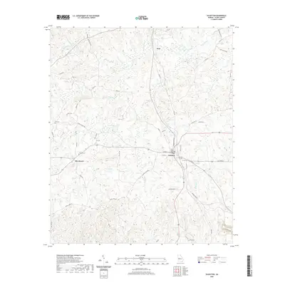
2020 Map of Talbotton
USGS Topo · Published 2020About this map
Talbotton serves as the focal point of this west Georgia landscape, centered around the Talbot County Courthouse. The town plan is defined by a traditional street grid including Washington Ave and Monroe St, which gives way to a network of rural routes such as Old Wire Rd and Packing House Rd. The surrounding countryside is dotted with small family and community burial grounds, including Oak Hill Cem, Carter Cem, and Culpepper Cem, providing vital reference points for genealogical research in Talbot County.
Find a feature on this map
59 named features on this map. Tap any name to fly to it.
Don’t see what you’re looking for? This feature index may not catch every label — zoom into the map to look around manually.
Map Details
Editions of this 2020 Talbotton Map
This is the sole edition of this map. No revisions or reprints were ever made.
Other maps of this area

1907 · Talbotton
USGS Topo · 1:125,000

1934 · Warm Springs
USGS Topo · 1:62,500

1935 · Thomaston
USGS Topo · 1:48,000

1936 · Warm Springs
USGS Topo · 1:62,500

1939 · Thomaston
USGS Topo · 1:62,500

1949 · Upatoi
USGS Topo · 1:24,000

1950 · Talbotton
USGS Topo · 1:24,000

1950 · Geneva
USGS Topo · 1:24,000

1950 · Waverly Hall
USGS Topo · 1:24,000

1950 · Talbotton
USGS Topo · 1:62,500