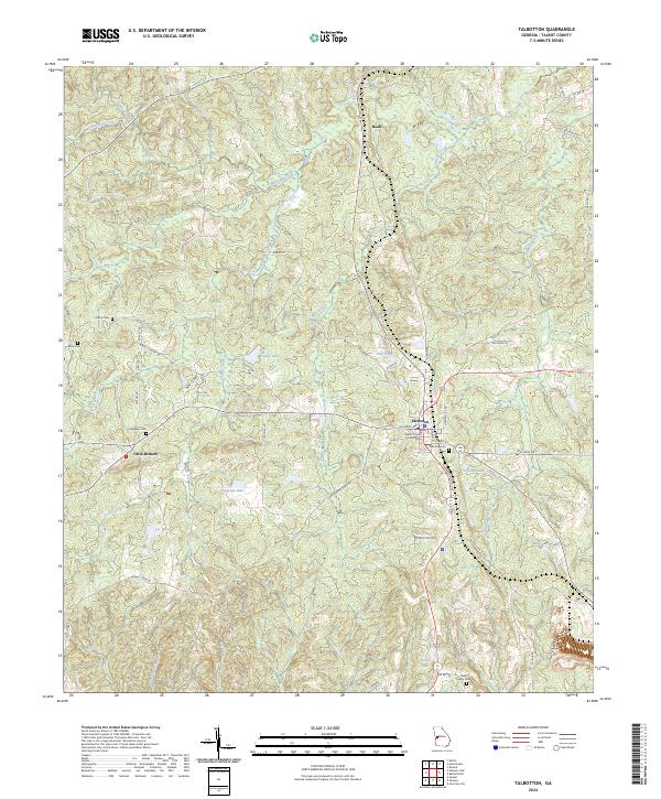
2024 Map of Talbotton
USGS Topo · Published 2024About this map
Talbotton serves as the focal point of this West Georgia landscape, anchored by the Talbot County Courthouse and the nearby Talbotton City Cem. The settlement pattern follows a network of local roads and state routes, including Old Wire Rd and Washington Ave, which connect the town to outlying communities like Olive Branch and Beall. The terrain is defined by a dense drainage system where Lazer Creek, Edwards Creek, and Marshall Creek wind through the hills, feeding several small impoundments such as Jordan Lake and Lee Lake. Family history is deeply rooted in the land, evidenced by several small, dispersed burial sites like Steed Family Cem, Carter Cem, and Culpepper Cem. This mapping captures the contemporary intersection of established civic infrastructure and the persistent rural character of the region.
Find a feature on this map
60 named features on this map. Tap any name to fly to it.
Don’t see what you’re looking for? This feature index may not catch every label — zoom into the map to look around manually.
Map Details
Editions of this 2024 Talbotton Map
This is the sole edition of this map. No revisions or reprints were ever made.
Other maps of this area

1907 · Talbotton
USGS Topo · 1:125,000

1934 · Warm Springs
USGS Topo · 1:62,500

1935 · Thomaston
USGS Topo · 1:48,000

1936 · Warm Springs
USGS Topo · 1:62,500

1939 · Thomaston
USGS Topo · 1:62,500

1949 · Upatoi
USGS Topo · 1:24,000

1950 · Talbotton
USGS Topo · 1:24,000

1950 · Geneva
USGS Topo · 1:24,000

1950 · Waverly Hall
USGS Topo · 1:24,000

1950 · Talbotton
USGS Topo · 1:62,500