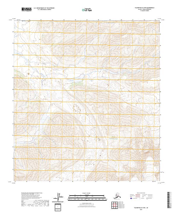
2023 Map of Talkeetna D-4 NW
USGS Topo · Published 2023About this map
Denali National Park and the adjacent Denali Wilderness define this high-altitude landscape in the heart of the Alaska Range. This modern topographic survey illustrates a strictly preserved natural corridor where human infrastructure is entirely absent, replaced by a complex network of glacial drainages and steep relief. The Swift Fork river system dominates the central drainage, winding through deep valley contours while the smaller Barren Creek cuts through the northern reaches. The map highlights the intersection of several township and range boundaries, including t33n r14w and t22s r23w, which provide a vital framework for land management in this roadless wilderness. For those studying the geography of interior Alaska, this sheet provides a detailed accounting of the hydrologic patterns and elevation shifts that dictate the flow of the region's glacier-fed waters.
Find a feature on this map
11 named features on this map. Tap any name to fly to it.
Don’t see what you’re looking for? This feature index may not catch every label — zoom into the map to look around manually.
Map Details
Editions of this 2023 Talkeetna D-4 NW Map
This is the sole edition of this map. No revisions or reprints were ever made.
Other maps of this area

1950 · Talkeetna
USGS Topo · 1:250,000

1951 · Talkeetna
USGS Topo · 1:250,000

1952 · Mount McKinley
USGS Topo · 1:250,000

1952 · Mount McKinley A-5
USGS Topo · 1:63,360

1953 · Mount McKinley A-4
USGS Topo · 1:63,360

1954 · Mount McKinley A-4
USGS Topo · 1:63,360

1954 · Mount McKinley A-5
USGS Topo · 1:63,360

1958 · Talkeetna D-5
USGS Topo · 1:63,360

1958 · Talkeetna D-4
USGS Topo · 1:63,360

1958 · Talkeetna
USGS Topo · 1:250,000