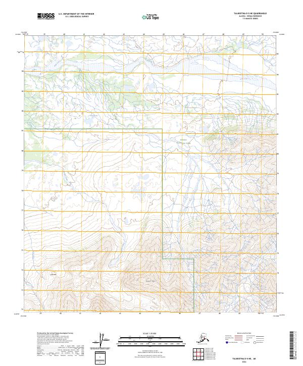
2024 Map of Talkeetna D-5 NE
USGS Topo · Published 2024About this map
Denali National Park and the Denali Wilderness dominate this Alaskan landscape, where the braided channels of Swift Fork create a wide alluvial corridor across the northern reach. The terrain rises sharply to the south, defined by prominent elevations such as Heart Mtn and Little Mtn. This area is characterized by its complex drainage network, where Boulder Creek, Camp Creek, and Canyon Creek carve through the high ground. The lack of established roads or structures emphasizes the wild character of the region, anchored by the quiet waters of Little Lake. The survey details the high-altitude topography and hydrological patterns of this interior Alaskan sanctuary as it remained into the early 2020s.
Find a feature on this map
17 named features on this map. Tap any name to fly to it.
Don’t see what you’re looking for? This feature index may not catch every label — zoom into the map to look around manually.
Map Details
Editions of this 2024 Talkeetna D-5 NE Map
This is the sole edition of this map. No revisions or reprints were ever made.
Other maps of this area

1950 · Talkeetna
USGS Topo · 1:250,000

1951 · Talkeetna
USGS Topo · 1:250,000

1952 · Mount McKinley
USGS Topo · 1:250,000

1952 · Mount McKinley A-5
USGS Topo · 1:63,360

1953 · Mount McKinley A-4
USGS Topo · 1:63,360

1954 · Mount McKinley A-4
USGS Topo · 1:63,360

1954 · Mount McKinley A-5
USGS Topo · 1:63,360

1958 · Talkeetna D-5
USGS Topo · 1:63,360

1958 · Talkeetna D-4
USGS Topo · 1:63,360

1958 · Talkeetna
USGS Topo · 1:250,000