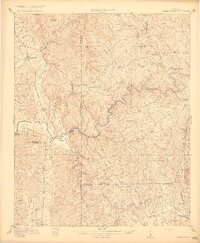
1916 Map of Talking Rock
USGS Topo · Published 1916About this map
Talking Rock and the surrounding North Georgia foothills appear here during a period of transition, where the rugged topography of the Blue Ridge meets the developing infrastructure of the early twentieth century. The Louisville and Nashville railroad runs along the eastern and northern edges of the sheet, connecting early industrial points like Whitestone and Talking Rock to larger markets. This rail presence, alongside historic thoroughfares like the Federal Road and the Nashville and Louisville Road, highlights the importance of this corridor for regional travel and transport.
Find a feature on this map
61 named features on this map. Tap any name to fly to it.
Don’t see what you’re looking for? This feature index may not catch every label — zoom into the map to look around manually.
Map Details
Editions of this 1916 Talking Rock Map
2 editions found

Other maps of this area

1886 · Dalton
USGS Topo · 1:125,000

1888 · Ellijay
USGS Topo · 1:125,000

1890 · Suwanee
USGS Topo · 1:125,000

1890 · Cartersville
USGS Topo · 1:125,000

1891 · Cartersville
USGS Topo · 1:125,000

1892 · Ellijay
USGS Topo · 1:125,000

1892 · Dalton
USGS Topo · 1:125,000

1894 · Suwanee
USGS Topo · 1:125,000

1896 · Cartersville
USGS Topo · 1:125,000

1897 · Dalton
USGS Topo · 1:125,000